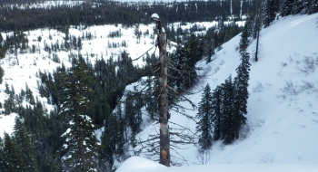
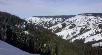
Albeit tricky skiing, some fun can be had in the North Fork Umatilla Wilderness near Tollgate, Oregon. The challenge is the mix of thickly and absently forested ridges with a variable snowpack between aspects that all funnel down to some nasty terrain traps. The culmination of this canyon can dramatically channel moisture upward during the right conditions to unload more snowfall than anywhere else in Eastern Oregon. The snow totals can be hit and miss from year to year though.
The access shown here is through a non-motorized winter recreation area called Horseshoe Prairie, starting at the Andies Prairie Snopark. It can be a madhouse on weekends with snowmobilers, sledders, crosscountry skiers, and snowshoers. However, very few alpine touring skiers and boarders visit here.
The route here follows the Umatilla Rim Trail, a great summer mountain bike trail that is also marked with blue diamonds for cross country skiing. The trail is a mostly flat and easy skin route. You start at the headwaters of the Umatilla River but the canyon carves deeply rather quickly. About 2 miles into it you'll begin to see your first 1000' ski lines down into the canyon to the north. Alternately, you can just skin straight across to your destination instead of following the summer trail.
This track just shows you some starter locations. You can continue indefinitely on the trail as it follows the rim to discover other ski lines. There is a groomed snowmobile trail that skirts to the south of the non-motorized area that can get you farther out if you want to access some ski lines off the trail around Johnson Creek, Buck Creek, or High Ridge with snow machine access. These look good from a mountain bike but I'm sorry to say I haven't tried skiing them yet. The farther out and down you go the more chance you'll run into thin snow cover.
Sadly, the only avalanche fatality in the Blue Mountains happened in 1999 on the north side of the canyon from this route shown here.
A Oregon snopark permit is required on parked vehicles.

