Bennet Peak, Two Color Lake Snowmobile Route - Wallowa Mountains, Oregon
Explore trail on map
#MainEagle
#Wallowas
#BennetPeak
#TwoColor
#TwoColorLake
Distance
Trailhead Altitude
Max. Altitude
Min. Altitude
Elev. Gain
Elev. Loss
Average Trail Slope
Max. Trail Slope

Trail Description

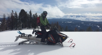
Bennet Peak rewards you after a successful technical climb with wide open gentle ridgetop riding and spectacular views. The climb in question is a bottleneck shortly before Bennet Peak that sends you up a narrow steep ridge with big mature trees that are difficult to navigate. Once you've topped out on this short ramp, it opens up again before and after the peak, which isn't much of a peak at all. There can be some difficult cornices to navigate approaching Bennet Peak but otherwise the riding is pretty easy until you want to go after the prize climb up Hummingbird.

The fire of 2015 burnt many of the trees up top, but really scorched the trees between Bennet Peak and Two Color Lake, which has opened some things up and will provide even more riding terrain in the upcoming years. Another benefit of this area is that the wilderness line is way on top of the ridge past Two Color Lake at about 8,300' which leaves you no guesswork on boundary encroachments as you ride around. It is also probably the highest you can get in the Wallowas legally on a snowmobile if you dare try the crazy climb up Hummingbird.

Trail data mapped by Brian Sather on Feb 9, 2016 · Last update: Dec 16, 2018

Waypoints

Bennet Peak

45.03802, -117.39518

Two Color Lake

45.06051, -117.3705

Parking — With enough snow this intersection provides a good turnaround and parking point.

44.99809, -117.61309

Parking — Potential for a couple bigger trailers to turnaround and park at cattle guard.

45.00302, -117.5875

Lick Creek Parking — Wide enough for parking, but not well maintained by snowplowing.

45.01691, -117.56845

Difficult Climb — This is a narrow steep climb with big trees that need to be navigated.

45.04396, -117.40953

Dangerous Avalanche Zone

45.06721, -117.37025

Video of route from Bennet to Two Color Lake

45.03922, -117.37304

Snowmobiling up Bennet Peak

45.04363, -117.41469

Photos

Looking toward Two Color Lake and Hummingbird Mountain from Bennet Peak area.Looking off into East Eagle
Running toward Bennet Peak, along the fresh burned timber of 2015
Burnt trees from the fire of 2015
Two Color Lake on the left with the big mountains ahead.