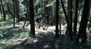
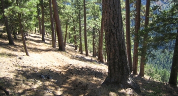
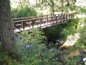
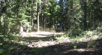
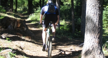
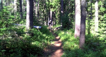
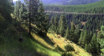
This somewhat obscure trail is surprisingly smooth and consistent for mountain biking. This trail is the ultimate out and back combination of climbing and descending. The trail meanders through slightly rolling terrain and then it treats you to alternating glimpses of parched Ponderosa side hill riding and tunnels of dense forest as it alternates from south and north sides of the ridge. Then you encounter a purely fast, fun, and challenging descent which will be equally the opposite when you come back. At the bottom your cross a foot bridge over the Lookinglass and then you climb up to the trailhead at Luger Springs Campground. The Lookinglass is a strong perennial river that is good for fishing. The climb is steady and surprisingly docile considering the volume of the rise. Any strong rider shouldn't have a problem pedaling up almost the entire grade. The ride will definitely have you taxed, but I guarantee you'll fall in love with this hidden gem once you've ridden it.
One major advantage of this trail is that it takes off right from the highway. Another major advantage is that it is bookended by two campgrounds. Woodland campground is just off the highway and at one end and Luger Springs is a primitive campground accessible by gravel road at the other. Plus, there are other trails nearby and also directly accessible from this trail. Loops can be made on gravel roads, but the out and back is singletrack the entire way. Do it from the Luger end or the Woodland end, depending on what type of workout you want.
Updates
- 8-12-12 This trail gets better every time I ride it. There is hardly any brush growth into the trail, low usage, little dust, no thorns, awesome bridge, no water crossings, shade, and great features on the downhill. Sound nearly perfect? Well, we did find a couple big logs across the trail that need to be cut out.
Ride Details
- 0.0 mi Start at the parking area at Woodland Campground and head up the rough road to the East. This is a short climb on a road only traveled by ATVs
- 0.4 Top out at a road. Look for a trail marker on the opposite site of the road where you will commence the singletrack. Immediately the trail crosses another road which is also identified by trail markers. The terrain rolls through the trees. The trail is mostly simple from here on. Just follow the singletrack and avoid a few trail offshoots.
- 1.9 Arrive at an intersection with 2 trail signs. Left loops you on the White Stag trail. Continue straight as the trail begins some downhill a short switchback sections.
- 2.7 Cruise by camping primitive camping area which is the end of Road 3701, which the trail has been flanking the last few miles.
- 2.9 Cross an ATV trail and immediately enters a thickly wooded section on the north edge of the ridge and winds through a tunnel of trees before coming out on an open ridge. Later, the trail crosses the ridge onto the barren side.
- 5.0 About halfway down, the trail crosses into an old growth section of trees with more technical steep section with occasional switchbacks that might require a dismount due to angle and loose soil. This is a really fun section though.
- 6.5 After winding around the front of the ridge, the trail drops you straight onto the Lookinglass Creek with a very sturdy bridge to cross. The trail immediately turns upward after the bridge with quite a few switchbacks and steep climbing up to Luger Springs Campground.
- 7.4 Cross the Powerline Road, a very rock not very well traveled road that is also rideable to Luger Springs. The singletrack continues a short jog over from the road crossing.
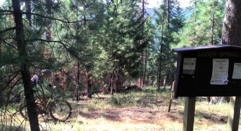
- 8.1 Arrive at Luger Springs Campground. The spring is a short ways downhill on the road, but don't plan to get water here due to the limited flow rate.
Driving Directions - Woodland
- The campground is near the summit on Hwy 82 between Elgin and Weston.
- There is a fee for overnight stay in the campground.
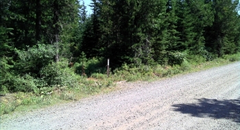
- Another place to access the trail is by going up the road a few hundred yards and turning right on Balloon Tree Road. Follow this about a half mile until the road splits. Find a parking place here . There are trail markers where the trail crosses the road and the singletrack begins.
- Trailhead location: N45 43.973 W118 01.792
Driving Directions — Luger Springs
- From La Grande at I-84 Exit 261, travel east on Highway 82-Elgin (Island Avenue).
- In Island City turn left staying on Wallowa Lake Highway 82 toward Elgin.
- In Elgin (19.2 miles) look for the sign for Weston-Tollgate Highway 204. Turn left.
- After crossing the railroad tracks, turn right on N 10th Ave. Continue on this as it veers right heading out of town.
- Follow this road for 3 miles and it will eventually meet up with Palmer Jct. Rd at a stop sign. Turn right and follow this road.
- At 34 miles, Palmer Jct. Road turns to gravel.
- At 37.5 meet a junction the indicates "Jubilee Lake" to the left. This is Rd 63, which is the one to take.
- The road will cross Mottet Creek at 40 miles and immediate come to a T junction with a sign. Take a left following the sign that indicates Luger Springs. This is Rd 6306. (to the right the road goes to Jubilee Lake)
- Follow this road 2 miles and look for a sign for Eagle Ridge Trail, pointing to the right. This is Rd 060
- Stay left onto Rd 051 when the road splits again and you will immediately come upon the campground.
- The total drive is 43 miles.
- Trailhead location: N45 45.619 W117 57.498
