A very aggressive but consistent climb on a trail that takes you fairly businesslike to a ridge that unveils a cool summit in the very north end of the Wallowa Mountains. The trail follows the ridge once you get on top and wraps around the north side of the summit where you can walk across the rocks to where the old lookout used to be. You continue on the ridge to the Goat Creek Trail intersection. The trail continues on the ridge but becomes the Storm Lake Trail at that point.
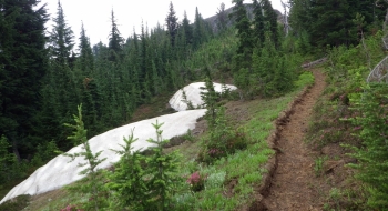
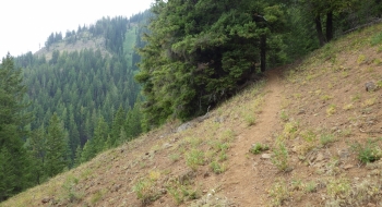
Huckleberry Mountain does have huckleberries on it but they're pretty high up so expect to see them late in the season but you might be too out of breath to enjoy them. As the trail eases up before the ridge, there are some camping options that are fairly sheltered. You instantly get a panoramic view to the south of the Wallowa Mountains. This trail offers a non-technical summit with a great view that is a rather easy day hike not far from the more popular areas of the Wallowas. Continuing on past Huckleberry Mountain, the trail isn't as well used and hard to follow at times. It never strays too far from the top of the ridge though, so you can't get lost.
Getting There
From Wallowa head up the canyon to the south. The road turns to gravel eventually and then there is one major fork in the road. Right goes to Boundary Campground and Bear Creek Trailhead. Left goes up to the Huckleberry Mt. Trailhead. The sign says rough road but it is in good condition without ruts. The climb is a steady climb up to the Huckleberry Mt. Trailhead. The real trail starts a short drive away from the actual trailhead if you can continue past the gate which is closed certain times of year (fall hunting season I think). Otherwise, the trail notes below explain the route from the trailhead.
Trail Notes
- 0.0mi Start at Huckleberry Mt. Trailhead and continue up the road to he west.
- 0.5 After crossing Little Bear Creek (which is very small), the singletrack trail begins to the left. You can actually drive to here if the gate is open.
- 1.9 Saddle between Baker and Huckleberry Mountain. There is a wilderness sign on the ground beside the trail. The Baker Trail is a dilapidated trail that heads down the ridge from here. You will continue toward the summit that you can see not far away.
- 2.1 Arrive near the summit where there is a rock cairn.
- 3.7 Arrive at a cairn on the right of the trail that is the Goat Creek Trail. There is no visible trail to the right there.


 coming up across Little Bear Creek and starting the real trail (right where the log cut is). There is no trail sign here so look for it to the south after crossing Little Bear Creek.")