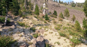
Sand Pass Trail drives you up and over Sand Pass, just like the sheep and stock of yesteryear. There's no mistaking why this is called "Sand Pass." Even though all the saddles along the Burger ChiCap Complex ridge are sandy, this one is extra beachy probably from the years of hooves. Animals still use it, but it is mostly just mountain goats and elk now, and the occasional human. When you reach the pass, you'll find The Gargoyles to the west still perched as sentinels to watch you drop rapidly down to Burger Meadow and meet up with the Elk Creek Trail.
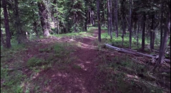
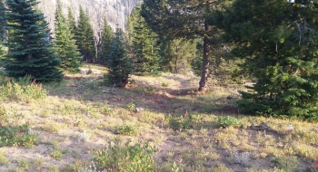
The trail is on an old road for the first mile and then departs to the left. There is a trail sign and from here on it is a more natural single track trail. It switches back a few times and gets on top of the ridge and follows that up to a huge meadow on a big slant, so I guess that would be a glade, but mostly it is just referred to as "the meadow." As you wrap around the left edge of the meadow, just before you go around the ridge you come to the intersection with the Mule Peak Trail. This is at 3.4 Miles and 6,711' elevation. You can take that trail if you are making a loop or if you simply want to go the Mule Peak way because it is a better maintained trail with greater views. The Mule Peak Trail will come back to the Sand Pass Trail at Sand Pass but it is more climbing and distance.
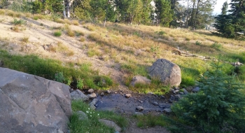
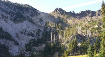
From the Mule Peak intersection the trail isn't so well maintained. It is fairly good until you get into the basin and cross Sand Pass Creek for the last time. You are in the Mule Peak burn through this section and the blowdown is bad for about a quarter mile or so. When you're out of the dead standing, progress improves but the trail has some washout issues. Thankfully, there are some rock stacks (of which I keep adding to) you can look for to keep you moving up the basin until you get a good visual on the pass. Once you get up sand pass, look left for The Gargoyles and then put your gaiters on because you're about to walk down a dune. There is a trail sign at Sand Pass that looks like a grave as you look up at it from either side. This marks the intersection where Mule Peak Trail comes in at Sand Pass. After you drop down to Burger Meadow, the trail follows this beautiful place where Elk Creek starts and soon meets the Elk Creek Trail. From there, you can go left to Burger Pass and Buck Creek Trailhead or right down to the Minam River.
Getting There
The road to the Sand Pass Trailhead at Pole Creek has been improved during Summer 2014. You can either go over the ridge from past Buck Creek, which is rough, or come down from Taylor Green (via the road from Catherine Summit). Either way includes several miles on gravel but it is all passable with regular passenger car. The old more direct road up Middle Fork Catherine Creek does not exist anymore.
Trail Notes
- 0.0 mi. Ford Pole Creek and begin trail.
- 0.4 Ford Sand Pass Creek. It shouldn't be a problem most of the year.
- 1.0 Trail departs the old road it was on and heads left up the mountain.
- 3.1 Shortly after trail enters meadow, make sure not to go straight on an old fire trail. The correct trail switches back and goes through the trees a the base of the meadow.
- 3.4 Intersection with Mule Peak Trail. Stay left for the Sand Pass Trail (elev. 6731', total ascent 1882' at intersection.)
- 3.8 Cross Sand Pass Creek
- 5.3 Sand Pass (elev. 8090'). Upper intersection with Mule Peak Trail which goes to the right. You can see Mule Peak Lookout from here.
- 5.7 Burger Meadow
- 6.0 End of trail at intersection with Elk Creek Trail near Burger Pass.