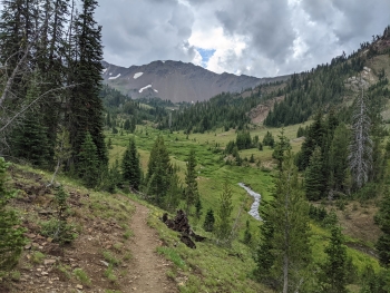
This hike from near Wallowa Lake, heads into the Eagle Cap Wilderness and goes by Aneroid Lake. It is steep and switch-backy out of the gate but soon mellows for some fast moving the rest of the way. You'll hit Rogers Lake and then Aneroid Lake. Aneroid is a privately-owned chunk of wilderness with cabins. Past the lake the trail cuts through a gap and opens into some beautiful alpine with views into the cirque of Pete's Point as you go up over Tenderfoot Pass.
The Wallowa Lake Trailhead is the starting point for several trails that head into the wilderness. The trail goes to the east, along the East Fork Wallowa River.
Notes
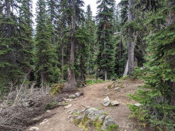
0.0 mi. The trailhead is at the very south end of the road beyond Wallowa Lake. There is a cluster of multi-use parking and you start up what looks like a dirt road but quickly there is a trail sign to guide you. There is an alternate route to follow the dam access road which climbs very steeply on the other side of the rushing creek.
1.9 At a switchback in the trail you'll see a sturdy bridge that crosses over the stream and goes to the access road.
2.2 Arrive at the pond that is dammed for controlling the water flow.
6.0 Rogers Lake
6.5 Aneroid Lake. This is a privately-owned lake.
7.4 Intersection with Bonney Lakes Trail, stay right to continue to Tenderfoot Pass.
8.5 Tenderfoot Pass Elev. 8,486'
8.8 Trail intersection, official end to trail. Left is the North Fork Imnaha Trail which takes you down the Imnaha or to Bonney Lakes and right is the Polaris Pass trail.


 and Aneroid Mountain (right)")


.")
")