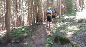
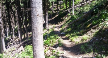
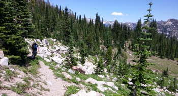
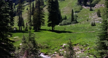
This is a long up and over of Burger Pass that gives you a fill of the basics that the Eagle Cap Wilderness offers. At the pass you are greeted with a breathtaking view of the entire range. Then you descend past some lush meadows, Burger Meadow being the first. When the trail starts zig zagging down the flank of China Cap you actually hike over small waterfalls on the trail and then meet up with Elk Creek for a few crossings and then follow it straight down through the thicker woods to the Minam River. There you will find a sturdy bridge crossing the pristine Minam River and meet up with the upper Minam River Trail on the other side. The Granite Trail isn't too far upstream from the bridge.
The first part of the trail is a relatively popular hike for Burger or China Cap summits, which both offer some great views into the Wallowas. The trail is also used quite a bit in the fall for hunters to access the Elk Creek area. There are a couple tricky trail intersections before Burger Pass. You'll stay right at both. The next two intersections are for Sand Pass Trail and Tombstone Lake Trail, stay left at both of those.
There has been a re-configuring of trails when the Buck Creek Campground was built. Some old trails spur off of this that were the original access points, but now you start right on top of the ridge at a higher elevation and head straight up to Burger Butte. Also, part of the old trail near Burger Meadow still exists and gets some use and maintenance. It is a more direct but less scenic route between Tombstone Trail and Sand Pass Trail. If you are coming from the bottom side, it takes off to the left just before the trail goes over a creek after a waterfall. This can be confusing because there are no markings and the trail looks well defined here. See the map for where this trail starts and finishes.
A northwest forest pass is required. The campground is more of a parking lot for trailers. It has a vault toilet but no water at all.
Trail Notes
- 0.0 mi. Start at trailhead from Buck Creek Campground.
- 0.7 Trail junction with old trail that goes down to Squaw Creek. Stay right at this intersection.
- 1.1 The old trail comes up from the right.
- 2.8 Trail crosses big avalanche path.
- 3.6 Trail junction with China Cap Ridge Trail, stay right here. This junction isn't well marked and kind of confusing.
- 4.5 Burger Pass (elev. 7958')
- 5.1 Junction with Sand Pass Trail near Burger Meadow. Stay straight (left).
- 7.5 Junction with Tombstone Lake Trail. Stay left.
- 11.1 Bridge across Minam River and meet Minam River Trail (elev. 4898')


")