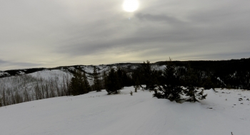
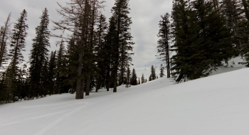
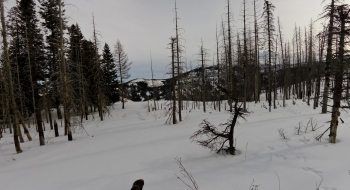
The Salt Trail is more of an assault trail on Young Ridge. It aggressively heads up the ridge to Ben Point from near Moss Springs. However, you won't find this on any maps since the Forest Service decided to erase evidence of this trail. It is a shame when trails are decommissioned. This one offers a direct and quick route up to the beautiful Young Ridge. Even though it is still recovering from over-grazing a century ago, it does capture your soul with a 360 degree view on a gentle sloping ramp. Young Ridge also serves as a visual snow gauge from the Grande Ronde Valley since it is visible into the late spring as a white ridge framed among green hillsides. Once the white disappears, that means many of the trails of the Eagle Cap are open.
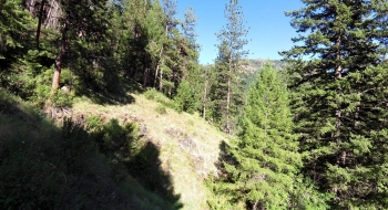
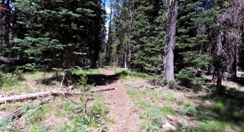
The trail is horrible at the start and even worse up top on the ridge. You find the trail start where the Lackey's Hole trail bottoms out, just before you get to Fireline Creek. It is a feint path to the left. You have to hop several logs across the trail and then come to an old fire pit for a camp spot. There is were you need to cross the Little Minam and head up the hill. The trail used to switch back several times but has mostly fallen apart so you need to hike up the hillside until you catch it. It stays on the open southern ridge. Once you get up a little higher the trail is much easier to follow as it says on the south side for a big long side-hill traverse, eventually deciding to switch back once and finally get on the ridge top. There, you will wish you were back on the hillside because the blow down is ridiculous for how few trees exist on the ridge. It almost seems like a sabotage job. The trail bed is well established most of the way, perhaps too much so because in places it is deep and cupped, but judging by trees growing right in the middle of the trail that look to be 20+ years old, there definitely hasn't been much done with this trail for a long time. You stay right on top of the ridge weaving around some rocky sections and past the inauspicious Ben Point. A little later you go to the left (north) of a huge lava rock formation that is very visible from many locations in the area, so if you need a frame of reference to pick up this trail coming from the other direction, look for these rocks.
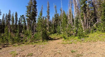
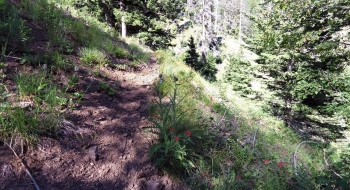
Things don't improve until you reach the Mud Springs Cut-off, also an unofficial trail, that was created a very long time ago when they drove a cat up to terrace Young Ridge. Most people come up that way so the trail is more well-used from that point forward. The ridge was eroding from all the sheep, so the cat dug terraces to reduce erosion and these are still visible on the hillside. After this trail junction, which is near a small stream and camp spot, the trail comes into an open huge meadow with Young Ridge visible in front of you. The trail soon splits and you'll want to stay right. Left goes to another meadow and a horse camp so it is more of a hunters trail. The trail right is the cat track and goes through a short section of trees and then opens up again for a view of the ridge and hike through wildflowers. The trail still has some erosion problems as it diagonals across Young Ridge and then tops out. Next the trail turns uphill steeply by Mud Spring and then follows the ridge over to connect with the Jim White Trail at an old dead tree with a sign on it.
Barstad (Hiking Oregon's Eagle Cap Wilderness) has this trail featured as the "Ben Point Trail #1929" and describes it coming in from the Horse Ranch Trail but I didn't see a clear path from there. His description has it crossing several mud holes and small streams so the entrance I have from Lackey's Hole should be better and also more direct. In any case, he has a great description of this trail from the 90s and it sounded bad then too so there has been no progress on this trail. Some of the locals use it though.
Trail Notes
- 0.0mi. Trail start from Lackey's Hole Trail near Fireline Creek
- 2.1 Ben Point
- 2.7 Lava rock field
- 3.0 Intersection with Mud Spring Cut-off
- 3.2 Trail splits, stay right
- 4.4 Mud Spring


 and Salt Trail not visible on right.")