This hidden gem of a trail is sandwiched in the midst of a lot of trail options around the Little Minam River. You'll rise up to Crib Point and cover some distance quickly from there to Deadhorse Flat, but then you'll be the one crying if you drop off the other side to Catherine Meadow because that trail is in horrible shape and you'll enter a ravenous mosquito zone much of the summer. Instead of doing that, at Deadhorse Flat you can get on the Cartwheel Ridge Trail in either direction to make a loop of this trail. It is excellent for trail runners to use as a loop with a nice running surface if you loop this and Dobbin Creek or if you want more rugged running with better visuals go to the top of Cartwheel Ridge and come down one of the options from there.
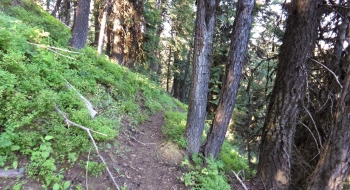
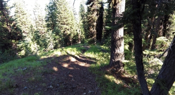
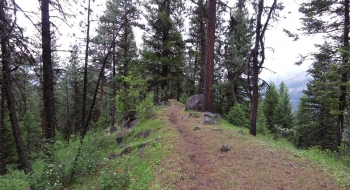
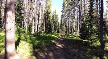
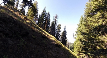
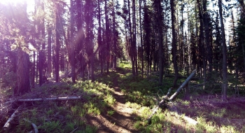
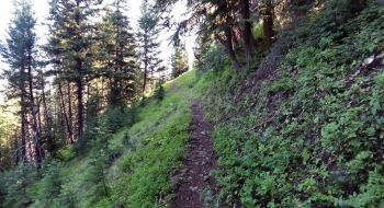
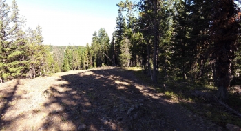
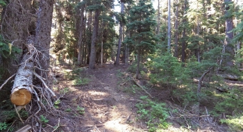
Things escalate quickly at the start of the trail, with some long lines across the mountain and easy-going switchbacks. The surface is in great condition and the trail well thought out. You top out quickly and it becomes more of a straight shot along the top of the ridge, probably on an old road surface. There are some erosion problems on this section as the trail needs some water diversions, but it is wide and not too bad. You get a few glimpses of the surroundings on your way up, but mostly you're in some evenly spaced trees with a nice feel. The climb is gentle the rest of the way. Along the way you pass Crib Point, which is the high point and the trail goes gently downhill. The first water source will be a small stream crossing shortly after Crib Point, but before Deadhorse Flat.
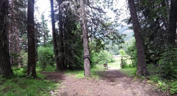
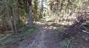
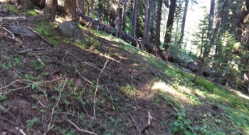
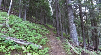
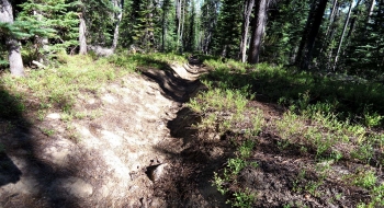
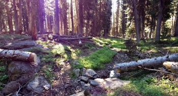
Deadhorse Flat is a small lush meadow where the trail enters directly and disappears. There is a trail sign in the middle of the meadow. If you head for this and then trend left a little you'll find the trail on the other side of the meadow. Cartwheel Ridge Trail enters and exists the meadow almost directly perpendicular from where you come into the sign. To stick with Crib Point trail, look for a log cut after passing the sign. It then crossing a small stream and heads toward a point called Ambush Point. At least, that is what I think it is called because the sign at the very end of this trail has "Ambush Point" unofficially written on it. Maybe that explains the dead horse. My theory is that is where the mosquitoes start attacking you. Then, the trail begins some switchbacks down the mountain where you have to weave around some big trees across the trail. At the bottom you reach the North Fork Catherine Creek Trail just up from the cabin at Catherine Meadow.
There is a trail sign at the junction that could be confusing, because it has the "Ambush Point" clearly indicated and pointing up this trail but the "Deadhorse Flat" seems to point toward Catherine Meadow. I think that is because the tree grew and pushed the sign to point the wrong direction. In any case, if you're starting this trail from Catherine Meadow, follow the Ambush Point sign and head up this trail. Catherine Creek flows gently by the trail junction, happily breading killer mosquitoes. Catherine Cabin is open on a first-come, first-serve basis.
Trail Notes
- 0.0 mi. The trail starts off the Lackeys Hole Trail just after you cross Dobbin Creek but before you cross the Little Minam. There is a sign on the tree but no distinct trail intersection because there is a camp spot right at the trail entrance.
- 2.4 Crib Point
- 3.0 Stream crossing
- 3.5 Deadhorse Flat trail junction with Cartwheel Ridge
- 3.8 Ambush Point?