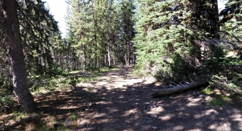
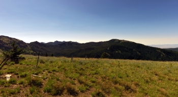
Cartwheel Ridge is a meandering trail along a subtle ridge that follows an old road, hence probably the trail name. The double ruts are still visible for most of the trip. It is a nice route from Lodgepole Trail that takes you by two other trails before starting to open up with expansive views and plugging you deeper into the Minam area. Near the end you experience a twist in your wilderness experience when you come to a barbwire fence and gate. From there, the trail starts to sidehill and becomes a single track as it swaps from the south side of the ridge to the north side and plugs into a trail junction with Lakeys Hole and Jim White trails.
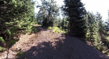
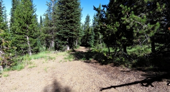
The trail starts at a marked intersection on the Lodgepole Trail that clearly has the old road crossing the trail. You'll go east at this junction. The trail surface gives you many options to weave between ruts--the experience is quite unique by trail standards in the Eagle Cap. After a small meadow you have a junction with the upper end of Dobbin Trail that is hard to find. The meadow at Deadhorse Flat is unmistakable though and you'll find this damp and lush with a trail sign in the middle. Just keep going across that meadow and cross the small stream on the far end to pick up the clear trail entrance again. For much of the route you're in the trees, sometimes thicker old growth.
Trail Notes
- 0.0 mi. Trail starts from a four-way intersection on Lodgepole Trail
- 1.0 junction with unmarked Dobbin Trail on left.
- 1.7 Deadhorse Flat meadow and intersection crossing the Crib Point Trail. Right goes to Catherine Meadow and left goes to the Little Minam. Stay straight across the meadow.
- 3.9 Fence. Trail turns to true singletrack and becomes more rugged.
- 4.4 End of trail at four-way intersection where the Lackeys Hole Crosses left and right and straight continues on Jim White Trail or to Young Ridge via Salt Trail.


.")