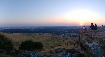
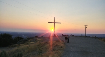
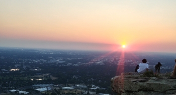
Table Rock is the local, scenic mound of rock and cliffs that overlooks the Boise and the surrounding mountains. It can be accessed by a variety of trails, or the not-so-official ATV track on the northeast side. Atop the precipice, a 60-foot tall illuminated cross stands. It is the contention point between different groups fighting over control of the land (see more about it here). This is a popular spot for locals, so it is usually busy and heavy with foot traffic. What makes this trail popular is the closeness to downtown Boise. The #15 trail starts at the old Idaho State Penitentiary parking lot, and treks up the mountainside. This trail is suitable for hiking or mountain biking, but is moderate difficulty because the steepness increases towards the top; it's in good shape and is doable for most. The trail is mostly double track until the top where it turns into single track.
On the northeast side of Table Rock, is tdhe not-so-official trail—which is actually more like an off-road redneck trail. It is not far distance wise, but is a fairly steep climb. Even during weekdays, this side gets a lot of traffic and vehicles parked below the gate. A security company locks the gate at 9 PM; otherwise, you can drive to the top of Table Rock in a vehicle to the upper parking lot. Looking north you can see the Boise Mountains, and on the south-side is the Owyhee Mountains.
The #15 trail goes up to the top, and then from there you can take a couple other trails to loop around the area, or back to the #15 trail towards the state pen. There is a larger trail system that makes up this area. There isn't an official trail map available, so there are discrepancies about where the trail actual goes. There are about half a dozen trails and connectors that make up this trail system.
Getting there
From downtown Boise to the prison:
- Follow E Myrtle St to Walnut St
- Turn onto Warm Springs Ave
- Arrive at the Old Penitentiary
From downtown Boise to access road:
- Get on Warm Springs Ave, turn onto Pierce St
- Road turns into Shenandoah Dr (right)
- Turn right on Shaw Mountain Rd
- Stay right, turns into E Table Rock Rd
- Arrive at gravel section as seen on maps


