The reward for this hike is one of the top five vistas in the Wallowas. The highest point of the trail is only a short hike from the summit of Granite Butte, which has a flat grassy top above cliffs that yield a killer panorama. You not only see the expanse of the entire Eagle Cap but you can turn the other direction to see the Elkhorns and Blue Mountains and all of the valleys to the west of the Wallowas. Mule Peak Lookout is perched on a high point of a sub-ridge off Granite Butte and this trail goes right beside it. The lookout is an active fire service structure that is manned during certain times of the late summer. Built in 1924, this is a ground structure that is the second highest house in Oregon at 8679' (Mt. Scott at Crater Lake is 8962'). It is also the second oldest lookout in Oregon to Black Butte by a year.
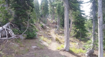
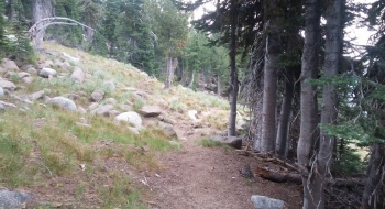
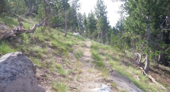
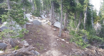
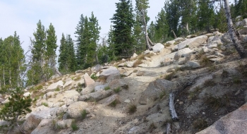
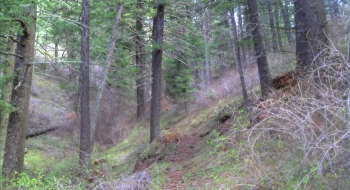
The route is strenuous from an elevation gain standpoint as you climb 3,800' but the trail is in good shape and visually appealing. The trail starts at an inconspicuous intersection with the Sand Pass Trail at the left side of a meadow, already roughly halfway up your total ascent. It then traverses across the meadow to a lone clump of trees and goes right through the middle of them before taking a couple switchbacks and following the top side of a sagebrush patch and continuing up to the narrow point at the top of the meadow. From there, the trail improves drastically. The switchbacks start wide and continue to narrow as you go up the pyramid shaped flank of Mule Peak. You pass a spring along the way that serves as the main water source for the lookout. Eventually you get a glimpse of the lookout to inspire you to finish the climb. After the lookout, the trail drops through a couple saddles and arcs over the flank of Granite Butte. The trail disappears a bit through a sandy stretch after that and then becomes good again as it works down the backside of the ridge to meet up with Sand Pass. You'll get a good view of Burger Meadow there and also make sure to look for The Gargoyles atop the ridge on the other side of Sand Pass.
While Eagle Cap is the only mountain in the Wallowas with an official trail to the top, this trail is so close to the summit of Granite Butte it might as well be a summit trail. As the trail goes along the flank, at the point it tops out you just detour and hike straight up to the top. It is not technical at all.
Another popular way to do this trail is by hitting it from Buck Creek Trailhead via Burger Pass in the opposite direction and going up to Granite Butte and Mule Peak then returning the way you came. A good strenuous trail run includes Sand Pass Trail and this one, but probably best in counter clockwise direction.
Getting There
The road to the Sand Pass Trailhead at Pole Creek has been improved during Summer 2014. You can either go over the ridge from past Buck Creek, which is rough, or come down from Taylor Green (via the road from Catherine Summit). Either way includes several miles on gravel but it is all passable with regular passenger car. The old more direct route up Middle Fork Catherine Creek has been permanently removed as a road to restore fish habitat.
Trail Notes
- 0.0 mi. Trail starts 3.4 miles up the Sand Pass Trail (elev. 6,731').
- 0.2 Trail has its first swtichback just after going through a small clump of trees in the middle of the meadow.
- 1.3 The Lookout Spring is on the right (7,781' elevation).
- 2.2 Mule Peak Lookout (8,556' elevation).
- 2.6 High point of trail on Granite Butte, turn uphill off the trail here if you want to summit (8,519' elevation).
- 3.0 Sand Pass. Trail connects with Sand Pass Trail


 and Granite Butte (right).")