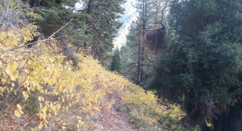
Fake Creek Trail is mostly fake. While it exists on a map, in reality it is a concoction of bad practice in trail making. For starters, there is fake footbridge. Then there are many sections of fake trail and real trail which are difficult to discern. Presumably there existed and old moderate incline trail with switchbacks and then people came along and decided to go steeply up the mountain to avoid all the tree fall down across the trail. This brings up the topic of fake maintenance; there are many trees across the trail and in some places trees were cut out but not on the trail. This is really confusing because usually when I lose a trail the first thing I look for are cut logs to guide me back onto an old trail bed.
To add to the confusion, animals have been busy creating fake trails that bisect the human trails. Also, there are some fake stick placements trying to guide you down a wrong trail. All of these factors lead to information overload in trying to determine what is real in the mess. These are especially an issue in the middle sections of the climbs on both sides of the ridge. The trails are trying to hold to the sides of very steep slopes but then you get faked into taking one trail and it becomes a mad scramble to figure out what is the true trail and what is not. For example, I came into a section where a human-cut log faked me into taking a higher trail out to a location where all I could see below me were myriads of game and short-cut trails that had me relying on GPS to get back in the right proximity of an old trail.
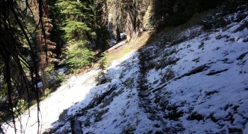
While this confusion was happening in the trees, above treeline is marred by major erosion problems. I'd see a massive ditch of a trail and follow it only to be faked into a section that had no visual trail or faked into following an actual stream bed (as opposed to a trail that water decided to poach). There are some new re-routes up top while the old trail still exists in places so you have a confusing trail intersection where they come together. For the most part, the GPS should be very accurate because I was thorough cleaning up the tracks.
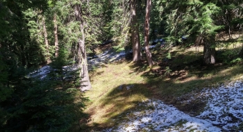
The starts at either end of the trail are well disguised, perhaps because someone is doing us a favor. On the other hand, maybe if the trail was better marked it would get more attention and maintenance. The nice thing about the trail is when you get up high you get some nice visuals into some seldom visited areas and there is a nice camping spot at the beginning of Jim Creek. The trail would be good as a hunting trail.
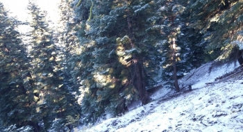
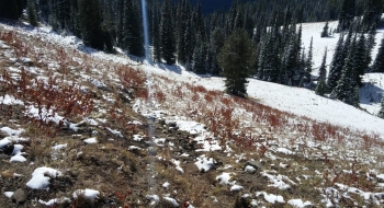
I didn't get a lot of great pictures of this adventure because it was cold and there was snow on the ground...plus I was uninspired. The visuals up high are nice but there were a few inches of snow on the ground so I couldn't provide an accurate representation of what you'll find up there in the summer. Don't expect to get any updated picture either because I won't be planning to travel this trail intentionally, probably for the rest of my life. It is a good spot to visit in the winter though, so I'll probably go backcountry skiing there again soon.
The trail is accessed a half mile down the West Eagle Trail from West Eagle Trailhead (depending on if yous start from the hiker or horse trail). There is a sign post with no sign on it and this trail starts to the right. If you're trying to find the trail from the Main Eagle end, you take the road that goes to Boulder Park Campground, but then take an immediate left onto a road that says "Service Road Do Not Enter." In a short distance there is a dirt road to the left beside the first A-frame cabin. You take that and you're on the trail but it is actually still a road up to the first switchback and then it is blocked off to become officially a singletrack trail although it is still an old road for a ways more.
Trail Notes
- 0.0 mi. Trail starts from the West Eagle Trail about 0.5 miles from the trailhead.
- 0.1 Trail crosses a very washed out Fake Creek, which may be raging earlier in the summer. The footbridge/log has been washed away.
- 1.8 Trail crosses the headwaters of Fake Creek.
- 2.0 Crossing of a spring and marshy area near the first ridge crossing.
- 2.2 Crossing of Jim Creek near a nice camp spot.
- 2.7 Arrive at the top of a ridge that is the high point of the trail (7,424' elevation).
- 2.8 A short ways down the ridge, look for the trail to drop diagonally off the ridge to the south and follow the high point of the spine above Little Boulder Creek. This is a section where the trail disappears a lot.
- 3.7 Another disappearing trail section, when it crosses a marshy spring area.
- 4.9 Trail starts picking up an old roadbed.
- 5.4 Official end/start of the singletrack as the trail comes out on a dirt road.
- 5.8 Arrive at Boulder Park Campground near Main Eagle Trailhead.


.")