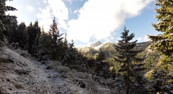
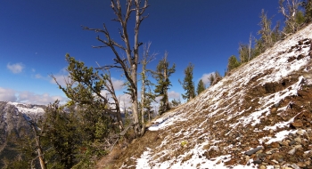
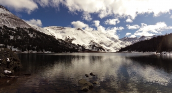
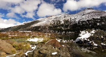
The path up and over to Frances Lake is characterized by very long switchbacks and shallow gradients, too many to count. Some of the traverses hardly have any elevation gain, making for an excruciatingly long ascent that will be worth it when you get the view into this basin that is tucked in the Hurricane Divide. It is an awesomely barren landscape set in front of Twin Peaks and some really cool terrain that spills down to Frances Lake and some lower pools it feeds into.
It is more common for stock to travel to the lake, probably because of the physical difficulty and length. Hikers will find it a difficult day hike to and from the lake. Backpackers will have a harder time hauling the weight up the climb and there are no camping options before the lake due to the steepness of the slope. There also isn't much opportunity for water on the trail late in the summer so plan to haul enough to get you to the lake.
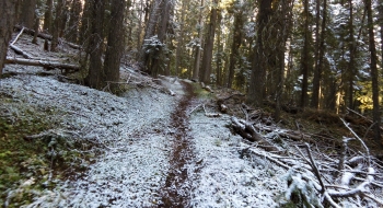
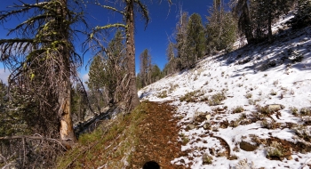
The start of the trail heads near the road and through a primitive camp spot before going straight up in an out-of-character way until reaching the first of the long traversing switchbacks. The hike up has a few good views across the canyon but mostly you are in the trees until you get higher up. You do get a nice look at a big cliff wall after you pass through the avalanche paths. The trail surface is especially good in the first 3 miles and then gets a little rockier up higher. It is kind of sliding down the mountain in places up high, but still good for hikers, horses, and mules. Unlike many of the high mountain trails of the Wallowas, it does not have big rocks to work through on the trail.
Trail Notes
- 0.0 mi. Start near the entrance to the trailhead parking, to the south at the sign that says "Frances Lake Trail."
- 7.3 Top of the ridge at 8,535' elevation.
- 9.1 Arrive at lake 7,717' elevation.