This trail connects you from the Lostine River to a high pass in the middle of the Wallowas, where you can access either the Upper Minam (via Granite Gulch) or the North Minam by way of Swamp Lake and Steamboat Lake. The latter will likely be your destination because you won't want to miss visiting those high-lakes basins.
The trail starts at a trail junction almost 3 miles up from Two Pan Trailhead. It immediately forces you to cross the West Lostine River, which can be higher than knee deep early in the season but dissipates as the year goes on to the point you may not need to get your feet wet. From there you start some climbing before a crossing of Copper Creek, which also can be fierce. There are more crossings of the creek higher up but these won't be as bad.
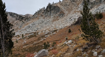
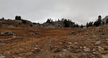
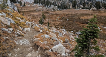
After meandering up through the bottom of the basin the trail turns north and begins an ascent up a steep slope before settling down to give you a visual treat as you work up to the top of the pass. Near the top, Swamp Lake will come into view to the north.
Trail Notes
- 0.0mi. Start at the trail trail junction on the West Fork Lostine Trail. This is 2.8 miles up from Two Pan.
- 0.1 Ford the West Lostine River, which can be flowing fast and over knee deep early in the season.
- 1.0 First ford of Copper Creek
- 1.8 Second ford of Copper Creek
- 3.8 Pass by Sky Lake, a short ways to the east of the trail.
- 4.4 Overlook the basin with Swamp Lake
- 5.1 End of trail at a junction with the Granite Trail heading south and west toward the Upper Minam and the North Minam Trail going north to Swamp Lake and Steamboat Lake.