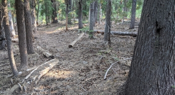
This hidden gem is hard to find but once you're on it you travel through a beautiful stand of hemlocks on a relatively flat stretch of trail that takes to you a secluded spot overlooking the canyons above the Little Minam River. It probably has some ancient history but in more recent times hunters use it to access some key terrain. The trail is a fantastic running surface and gradient.
The trail starts off on an old decommissioned jeep road in the meadows behind Mt. Fanny, from the 6220 road. Near the bottom meadow after crossing the wilderness line you can find a blaze on a tree that takes you onto the trail proper. This is the same area the Horseshoe Basin Trail takes off further downhill so make sure to stay left (east) on the blaze that takes you off the meadow after crossing a small stream. From there it is well-blazed and has a good trail surface. Near the end there is a fork with a spur to the right that goes to a nice overlook above Red's Horse Ranch area. There is a spring just below this fork. The main trail begins to dissipate and is hard to follow from that trail junction on, but it does open into grassy meadows with some nice views but a lot of dead timber on the ground makes it hard to get around. Word is there is an old crashed aircraft in the bottom of Big Canyon, down the ridge near the end of this trail.
During the making of this guide a lightning strike was called in by Pt. Prominence that burned 1 acre just north of the spring near the end of Long Ridge. Rappelers got it stopped quickly.
Notes
0.0 mi. Start from the 6220 Road and follow the mix of car/ATV tracks on the south side of the meadow.
0.3 After the first set of meadow, look for an old road opening from the meadow to the left that take you through a stand of trees.
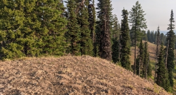
0.4 The road dissipates into what looks like a creek bed and some feint trail. Follow this downhill to where it opens into another set of meadows. You'll follow a variety of old trails and work down through the meadows trending to the higher left side of the meadow.
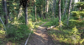
0.8 As you near the bottom of the meadows you will cross a creek on the left side and look for a big blaze on a tree lookers left of the meadow. Enter the trail here. It immediately climbs for a bit then levels out.
1.4 The trail takes a more abrupt left here. Keep an eye out for trail blazes to the left. It seems an old driveway for sheep continued on toward Huckleberry Ridge at this point.
1.6 An old blazed trail cut-off to the Huckleberry Trail comes into the trail at this point. It is difficult to see so shouldn't distract you from continuing out Long Ridge.
3.0 Fork where the overlook trail takes off to the right. This is where the spring is too.
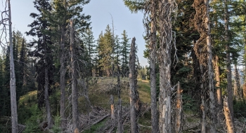
3.2 The trail comes out on a sidehill and quickly starts to dissipate. There is a more well established trail bed on the top of the ridge you'll need to cut up to but there is a lot of deadfall on it.
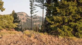
3.5 Not much trail exists the rest of the way, but you'll find better progress moving to the west side of the ridge and skirting the timber on the ground. The views are great there too. At certain times a year a waterfall can be seen between Dunns Bluff and Pine Butte.
3.9 Trail effectively ends at a rock cairn.