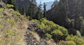
I have yet to travel a trail in the Hells Canyon Area that is pleasurable. Saddle Creek is no exception, but it is one of the better ones--which is basically like winning an undesirable contest like a hot-dog eating competition. I first hiked this trail in the 90s with some college buddies. Back then it was mercilessly long and rugged. Due to little use or maintenance since then, the trail is now long, merciless, even more rugged, and jungle-like in places. The problem with the jungle sections on the lower stretches is that they could kill or harm you because of rattlesnakes and poison ivy.
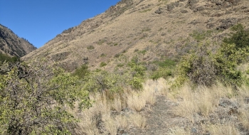
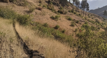
The first stretch of trail is more well used up to Freezeout Saddle, mainly by free-range cattle. After the saddle it is still benched out well with a series of switchbacks until you reach the intersection with the High Trail. From there on, no one is using it. Even the lower few miles above the Snake River aren't well used, which you think would happen because of the frequency of rafters camping on Saddle Creek. There is definitely a rugged beauty about being on the trail in this country, but you really need battle armor and a hazmat suit to move down the trail with any sort of purpose.
The old Saddle Creek homestead at the Snake River is a nice spot. You can still see rock walls for fencing, fruit trees, and other elements of the old farm. You feel a great sense of accomplishment making it to the river, until you become a side-attraction for jet boats motoring by with fresh-looking senior citizens. At that point it sinks in that you have to climb back out of there on the same trail you came in on. Saddle Creek is a well-used overnight spot for rafters. I was lucky enough to enjoy a night with local Canyon Outfitters out of Halfway, Oregon. Their cooking and hospitality energized me for the long haul out.
The trail has periodic water options which is really important given how hot and dry the region can be. The trough at the trailhead is spring fed and Freezeout Creek is flowing nearby. There is a stream flowing about a mile up the trail also. After the saddle the trail soon joins Saddle Creek which flows year round. Later it will cross Big Creek and do a couple crossings of Saddle Creek lower down.
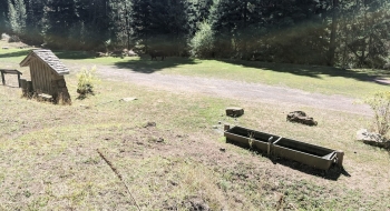
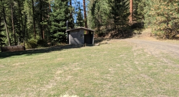
A Northwest Forest Pass is required at the trailhead, which is very much an insult after driving forever on a washboard road through private land and parking to ready your gear for embarking on a horrific trail. There is a vault toilet and disintegrating picnic table there so if you want to enjoy camping amongst the cowpies and bear scat you at least have a smelly toilet to sit with some flies.
Probably the least-worst time to do this trail is in the fall when the poison ivy is less active and the temperatures start to drop. Keep in mind that Freezeout Saddle is named that for a reason. The spring time can be pleasant, but the flora is thick, ticks are everywhere, the streams are swollen, and the snakes are coming out of hibernation and headed out from their dens. If you get bit, your only hope for anti-venom is to get to the Snake River and contact someone there or activate a personal locator beacon. A close landing zone and communication with a helicopter will be most difficult if not impossible on most of the trail and if search and rescue needs to come save you, plan on making terms with your demise. There is a reason they call this place Hell.
Trail Notes
0.0mi. Start on the trail just above the stock trough at Freezeout Saddle Trailhead.
0.9 Trail comes to a perennial creek in Saddle Gulch. A hunter trail takes off other side of the creek. Stay left and keep climbing up.
2.2 The old trail joins into the newer trail that you are on.
3.0 Freezeout Saddle (5,440' elev.). The trail tops out at the saddle where it also intersects with the Western Rim Trail.
5.0 Intersection with the High Trail where there is a marker and faded signage. The High Trail looks like the more well used trail to follow, so avoid going straight. Instead go downhill and attempt to stay with the Saddle Creek Trail as it trends right of a ridge staying with the flowing creek.
7.5 Big Creek. Trail crosses over this perennial stream that can be a good source for water.
8.6 Crossing of Saddle Creek. This can be difficult in the spring. There is a long stretch of trail that is very grown in and difficult.
9.3 Trail crosses over Saddle Creek again for the last time.
10.7 Intersection sign for the old dilapidated Upper Snake Trail.
11.4 Trail arrives at the Saddle Creek Homestead on the Snake River, where the Snake River Trail comes into it.