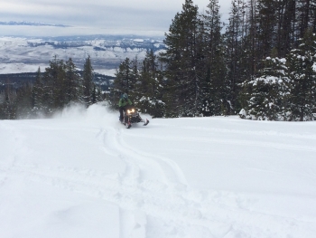
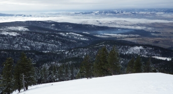
Mt. Fanny is one of the three uninspiring mountain tops surrounding the Grande Ronde Valley. Looking at the mountain most of the winter, you'd wonder where the snow is because it is mostly bare on the flanks; however, it generates loads of snow up top where the mountain benches out. Most of it is flatter with thick young forests but there are some skiable glades that are accessible by snowmobile if you want to do it sled-lift style. The roads switch back so much that running a sled around and picking people up is convenient. The terrain is pretty mellow but offers some interesting ski shots after Moss Springs. These are snowmobiled at times and narrow so get there at the right time to get fresh tracks.
The route here shows the snowmobile ride all the way to the summit if you want to do that. There are a few skiable turns off the summit but you start running out of snow quickly if you try to ski down the whole mountain. On occasion this is doable though, so take the opportunity to ski all the way down to Cove if you can.


