The Lodgepole trail is hoof-pulverized, rutted, and often very wide from careless bipedal and quadruped travelers. Both ends of the trail are superhighways of dust with the south end effected by free range cattle. At least the mountain bikers aren't to blame for any of this, because no one rides this trail and we never damage trails. Mountain bikers should ride this trail though. It offers a genuine Eagle Cap experience of the most popular trails (i.e. dust and ruts), minus the panoramic views.
Sarcasm aside, it really is a fantastic trail to ride, as it teases the wilderness boundary perhaps violating it a few times...or not. There aren't any wilderness markers on the trail except for just south of Moss Springs Campground where a couple small posts indicate wilderness entry but only for a couple hundred feet of the trail so perhaps you can pack your bike into the woods around these markers, so you stay on the other side of the boundary.
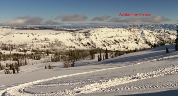
Even though the trail follows a ridge, there are surprisingly few views into the Wallowa Mountains. That doesn't matter though, because you need to focus on the trail to navigate the roots, rocks, and ruts. It is really challenging and fun riding, with some very entertaining descents. Both ends of the trail have some short steep sections that require walking but the rest of the trail undulates at modest gradients. The money feature of this trail is a section on the ridge with granite rock and some slickrock riding with even a few glimpses of the mountains and valleys in all directions. This is 2 miles into the trail and may serve as a good turn-around point for someone that wants a short ride and an awesome DH experience back to Moss Springs.
Lodgepole will best be ridden later in the year when the springs dry up, but hopefully after a rain storm to settle the dust. One way to do the trail is to ride north to south along the whole trail, and then continue down Forest Road 2038 for 13 miles of gravel downhill to Catherine Creek State Park for someone to pick you up. As an out-and-back option from Moss Springs, it is recommended to turn around at 7.5 to avoid the dusty silty descent down to the trailhead, which is no fun to try to ride/walk back up. Also, if you really want to go long on this ridge, you can plan a route in conjunction with Indian Creek Trail 1917 on the Breshears Trails via the dirt road up Mt. Fanny from Moss Springs Campground.
Regulations
The trailhead at Moss Springs requires a Northwest Forest Pass.
Trail Notes
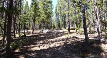
- 0.0mi. Start at the east end of Moss Springs Campground and go down the bermed-off road to the South. There is no specific "named" trailhead marker for this trail, so don't confuse it with the trails heading east down into the Minam and Reds Horse Ranch.
- 0.7 Arrive at a road where the real trailhead appears to begin, with markings indicating "Lodgepole Trail."
- 1.5 Trail crosses some old roads and what appears to be the abandoned old trail. The trail heads very steeply up to a ridge.
- 2.2 Arrive at a granite rock sections of the trail.
- 2.7 Trail comes to a small opening where another trail merges from the left, perhaps the old trail. This will only be confusing if traveling north on the trail. There is a sign and arrow for the Lodgepole Trail though.
- 5.5 Trail emerges into a beautiful meadow and then disappears. Look to the far side of the meadow, for a yellow sign on the tree and head for that to find the trail again. The same method can be used for traveling the other direction.
- 6.4 Trail intersection with Cartwheel Ridge Trail 1907 and Road 2036-200
- 7.5 If you're planning to go back, you may want to turn around here as the trail starts to turn to the right and plunge straight down the mountain.
- 8.4 Trail merges onto more of a road and goes over several mounds of dirt before reading the official trail. This area can be confusing if heading north on the trail, as the trail splits, with the official trail going up the mountain to the east.
- 8.8 Trailhead parking on south end, at the termination of Forest Road 2038, which comes up from near Catherine Creek State Park. There is not much indicating a trailhead here.