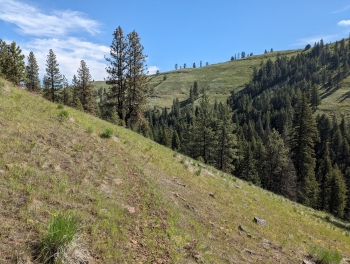
This is less of an epic mountain bike ride and more of an rugged adventure that involves your bike. The true enjoyment is in visiting the raw landscape that Native Americans once used in their seasonal migration. Nowadays this trail is mainly used for free range cattle ranchers to round up their cattle. The rest of the time, nothing seems to happen on the trails and no one seems to know about them. At one time in ancient history the Wallowa River flowed to the Snake through this canyon or Swamp Creek, but no one knows exactly how it changed its path.
This is a good early season route for hiking, trail running, or biking while the snow on many of the other trails. It could be good on a dirtbike though, but not many seem to attempt that. A promising aspect of this trail, is that the Sled Springs OHV tracks are nearby, so you could include this along with some other riding as a weekend destination near Flora, a nice place to be. The Sled Springs Stagecoach Station used to be a common stop-off for travelers in the 19th century, so you too can enjoy the same kind of perilous travel of yesteryear. Overall I'd say the terrain of this loop is better suited to horse, but don't let that deter you from some enjoyment via other means. It will be best to do late Spring or late Fall. Summer would be difficult due to lack of water, dust, and snakes.
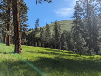
From a mountain bike standpoint, it is probably best to just take the Davis Creek Trail 1658 as an out and back, even though you could loop Swamp Creek and Chico Trail. There is 7 miles of singletrack down to the convergence with Swamp Creek. The 1 mile descent down to the Davis Creek on the Chico Trail 1658 could be raucous. Once you arrive at Davis Creek, the trail gets more fun, with a mellow and wide open descent. You may have to contend with a few cows, but hopefully not.
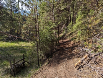
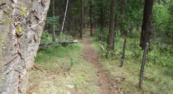
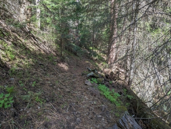
The trail is in mostly good shape. As you get farther away from the trailhead, you do start running into some brush that needs trimming when you wrap around to the north slopes of the inlet streams. The trail also needs some benching out on some of the side hills. It's rough in spots but easy to follow and mostly all rideable. Just realize this trail is more of a rugged adventure than a free-flowing mountain bike trail.
Both creeks are perennial, although Davis Creek will be dry at the upper end late in the year. Fording the creeks may be difficult certain times in the spring. You won't need to ford if you stay on the Davis Creek Trail the entire time.
There are no markings for the Chico Trailhead from the highway. It is no more than a quarter mile down a gravel road on the east of the highway across from the Sled Springs area near milepost 22.
Trial Notes
- 0.0 mi After the 1.1 mile descent from Chico Trailhead, go left to the north down Davis Creek. Across the creek there are 2 trails. The one to the left coming down off the mountain is the one you'll return on. To the right is a more well used cow trail along the fence that feeds you down to road on private land.
- 6.6 Trail intersection as the creek merges with Swamp Creek. Just before getting here, the trail kind of disappears, but you should keep heading down the ridge to pick it up as it crosses an inlet creek. You could follow the trail downstream for a long ways but it has lost its original path and now fords the stream way too often. It has been cut through for a four wheeler and eventually arrives at Joseph Creek at a cabin on private land that says "No Trespassing". It will be no fun on a bike. To complete the loop presented here, you will ford Davis Creek and, after a few hundred yards, ford Swamp Creek to pick up the trail going up the east side of Swamp Creek.


")