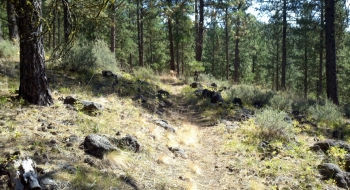
This is simple and short, moderately-difficult trail that climbs up to an overlook. It travels across Union Creek Rd. and then climbs across the mountain and makes one switchback to climb up to the overlook. The terminus of the trail is indistinct, but you'll know you are there when the trail disappears into a pile of rocks with a good view of the lake. The out-and-back is a good dig from the Phillips Shoreline Trail that is worth the view. The climb is a steady 8-10% gradient the entire way up. There is a way to loop back by finding 4WD roads at the top, but the singletrack descent will be more fun.
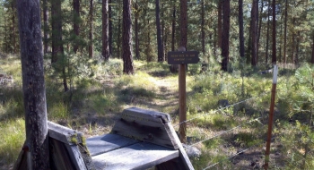
The beginning of the trail is not very apparent. It is directly across the highway from the entrance to Union Creek Campground. If accessing the trail form the Shoreline Trail, just ride up to the campground exit from the boat ramp. If driving to the trail, it is better to take Union Creek Rd about a quarter mile to where the trail crosses and park there.