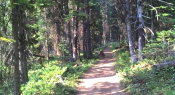
This is a ride through some beautiful terrain along the ridge north of Mt. Fanny. It is a two-track ATV trail the delivers awesome views and a cool mix of rock scabs, roots, and other rock surfaces. It is the Breashers Trail of the system with the same name and also known as the Grande Ronde Ridge Trail 1916. At the intersection with the Sixpack Singletrack Trail there is a placard on a tree in memory of Raymond Breshears who is credited for creating the system of motorcycle trails around Mt. Fanny.
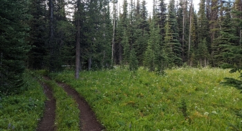
Around the middle point of the ridge there is a section where the trail splits and comes back together. The trail to the west is definitely the option to take because it winds over some great rock scabs with a good panorama. It is marked "Most Difficult" but that is an overstatement. It is mostly medium to easy except for one steep pitch where the trails comes back together on the north end of the split. In the upper stretches there is a side trail over to a Twin Spring, which has a pipe in the ground delivering some nice water. The top part of the trail meanders through some interesting natural gravel surfaces and a meadow before connecting with the road near Mt. Fanny Summit.
It is a choice climb on a mountain bike to access over to the Indian Creek 1917 trail. Some of the pitches are steep but it is worth the push and sets up perfectly for an eBike climb, then pop over for that ripping descent on Indian Creek.
There are a few different ways to get to this trail, so see our EnterActive map to figure out the preferred option.